Saturday, September 22: Fine but cold to begin with, increasing patchy cloud during the day and a couple of showers in the late afternoon
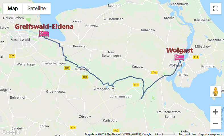
Hiking: 34.9 km
Pension am Peeneufer, Badstubenstr. 24, 17438 Wolgast, double as single with ensuite and breakfast, wifi (€49)
Up bright and early to have what little was being threatened for breakfast, and organise some stuff for along the track. Turned out there was more than the one slice of bread on offer, so all three could be had with jam, and the bread rolls occupied with cheese and sausage could be stashed away for lunch. There was OJ in addition to the coffee, and an egg as well. Had everything packed and ready to go – the host rather belatedly gave me my change from last night, and as I was leaving only the couple in the adjacent room were left to having their breakfast.
Went down to the supermarket in an attempt to redeem two of the soft drink bottles, to no avail, and bought a 1.5 L bottle of raspberry lemonade for a change. GPS tracker seemed to be working fine, except that the USB cover, which had thoroughly detached itself at the beginning of the trip is now missing, presumed dead. Not much of a loss, as it was always difficult to get on and stay on. I started walking out of town along the road. A bit of storm damage was lying around. The markers stopped fairly abruptly after leaving town and were absent for the next few km.
Managed to negotiate my way through Friedrichshagen as far as the railway line, but could see no way across, so I thought to try the red version, and there was a narrow track that led across the line. This could be simplified further by taking a half right turn on entering the forest, at least the lines would be straight. Overshot the mark a little after the railway crossing, but corrected the mistake in the further course and was now headed in the right direction (according to the solar compass). Had to stop once to see where I should be turning right. In the absence of markers I tried to go as far as possible before having to turn right, introducing a new variation on the path, and on coming out of the forest was rewarded by a pair of markers. There were sporadic markers through Hanshagen, and also out of town back into the forest, but I had to be careful to select the correct path as it leaves the road, and there was sufficient marking nearly all the way to Wrangelsburg.
After crossing back underneath some powerlines, I spotted a sign that led to a path to the right of both red and blue, and pretty soon there was a picnic table for me to have lunch at. After this I wandered off the path for a bit, then went back and found the markers again; and about 200 m after that I may have taken an illegal shortcut; because when red and blue finally met up with the path I was taking, I did see a marker coming from that direction, but I held it for poorly placed. Anyway, from now on the path was very straight, and marked with a combination of very old, but also some new markers, as far as the highway.
Over the other side, things were actually a bit grimmer than I had imagined. It was fine hunting for markers and following them, but what when they run out? I kept following the white-blue-white markers for longer than was sensible and ended up in Buddenhagen at the railway station. First had to get my orientation right, then found where I was on my maps, and walked back in a direction that would eventually lead me to a continuation of path, where a single marker turned up again, with only a couple following. Then they seemed to have run out completely.
I couldn’t see on my map what the name of the place was that I had to pass through, but could identify the photovoltaics built over what I presume used to be a rubbish dump. Down in Hohendorf and greeted by a sign that said “Stadt Wolgast” I now followed the cycle track into town. Rain clouds were making their presence felt increasingly, and as a few drops started to fall a shelter of sorts turned up and I used it to switch into rain togs. Not much of a shower (was over by the time I reached the very long Bahnhofstr.) but good practice.
OpenStreetMap
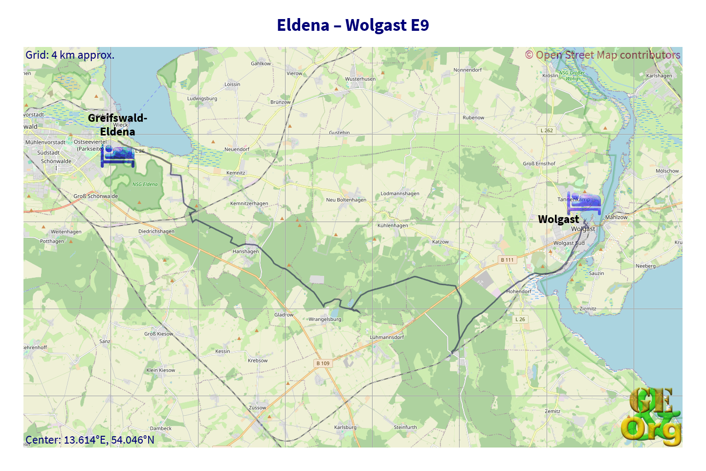
Almost there. GPS quality: 30/30, coverage: 100%
Now to find some cash and a place to stay. Several hotels were already visible by the time I had identified the first supermarket, and a short trip into town found a bank for the necessary cash. Asking at this place, the price was acceptable, wifi available, the room very modern, and both living and bathroom quite spacious due to the modern furnishings, and even has a fridge. Only drawback is being room #1 it is immediately behind the main door, let’s hope that not too many people return home drunk later this evening.
Next task was to try and figure out where to eat tonight (no Greek restaurants turned up, despite dedicated googling), then to try and get rid of the very East German lemonade bottles that the supermarket this morning refused to take. Not to much avail, except for some rain drops, but I had both the fleece jacket and the rain coat on. On the way home the sun shone from behind, and a rainbow soon became visible. One last check to see if there was a Rewe in town (not) and then it was off to the harbor and one of the islands to check out the restaurants. Settled on Der Speicher (Hafenstr. 22, 175438 Wolgast) for a Hamburger Schnitzel (schnitzel with two fried eggs and fried potatoes) for €14.5. Made up for the nearly 35 km on the track today.