Saturday, March 2: Sunny throughout, one or two low clouds
Tramping: 18.4 km
Puteore Hut (Doc, $10)
Around midnight I woke to what I thought were human voices. Didn’t think that the track was getting to me that quickly, not that I was dreaming. Got up to see what was up, and two young hunters, Lars and Jason had arrived and, seeing my boots hung up at the entrance, were having a drink before deciding on further action.
I ushered them into the hut, pushed all of my gear aside to make room for them, and they dumped their sleeping bags on the upper deck and asked whether they could bring their weapons in, unloaded, of course. With that out of the way, there was also a 24 pack of some RTD plonked on the table, the partaking of which I negated. They had started from the road end at around 7:00 and done most of the track in the dark, with Jason unable to use his headlamp because it had been switched on accidentally in their car and the batteries had run out. With those formalities out of the way we all retired to bed and slept.
It was very cold in the morning and I had had to put on the fleece jacket for at least some warmth. In any case I was up at 7:00 and had all my stuff eaten and packed, and was away by 8:30, while the others dozed on.
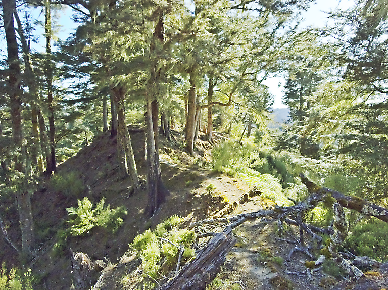
Today was going to be a long and difficult day. For the most part the track was well marked and I could hazard a guess as to where I was. A ridge track does go up and down a lot, but that was not the problem: On the main east-west ridge there was abundant vegetation in the form of ferns and bushes, which was more like swimming through the botany rather than having it as an accompaniment. Along the initial north-south ridge Taranaki made an early appearance and the going was reasonable: I reached Tahupo Hut after just four hours, and had lunch there. Hydration was getting to be a bit of a concern, and I had to make do with 1½ L of raw tank water for lunch.
Slide Show
Click on the image to stop/start the animation
The next part was signed also as five hours, and that is what I did it in. Here there was not much of a problem with swimming through the vegetation, but with windfall and about half-a-dozen places where the route marking was not clear and required quite a bit of reconnaissance to solve the task. That said, the “sprinkling” of orange markers is an understatement: In most cases they are sufficient, and some of them appear to be recent. The real problem is that the markers run out *just before* the hut, and I haven’t yet seen how the track actually gets here.
After about 2½ hours on this track I had a longer break and took out the map. I could identify two possible places where I could have been: Unfortunately the less optimistic position was probably correct. After this there were two further places where signs had to be searched for, although by this time I was getting into the rhythm of looking for the next saddle and its subsequent climb.
Just after 6:00 I reached the “turn-off point” for a route that goes directly to the middle of the Matemateaonga, although it is not signed. I had only about 800 m to go, and the track went in the right direction until, as I’ve said, just before the end where it appeared to go via the downhill side of the hut where there was quite a lot of rubbish as well as traces of an older hut and latrine. Since the hut itself would not have been rebuilt on a slope a dedicated bushbash to the top of the ridge brought me directly to the hut, as well as a couple of scratches (not to mention the bruised shins from earlier in the day).
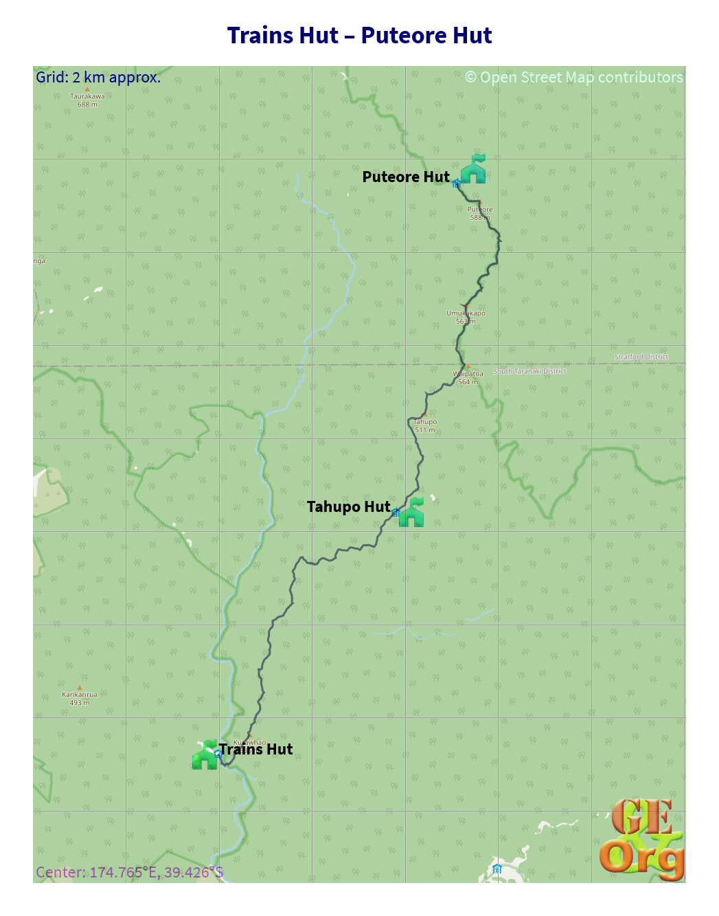
OpenStreetMap
Onto the wild ridge. GPS quality: 30/30, coverage: 100%
Once at the hut, everything had to be unpacked. Dinner had to be cooked, and in parallel feet and sox washed. However, as the meal was nearing completion I felt a bit crook: Possibly because of the untreated water that had been drunk all day in large amounts, possibly because I was desalinated, possibly because it was such a strenuous day (especially underfoot), or possibly something else, because I had had only three muesli bars for lunch.
I thought the best thing would be to stop cooking the meal and have a lie-down for a bit. After that I thought I might stomach something so poured myself a cup of the rice/peas mix and had a couple of spoonfuls of it with salt, then lay down again. The next time I finished the cup (with quite a bit of salt) and that was OK, but I couldn’t complete the rest of it so I threw it away. Still thirsty, still a bit of a temperature, perhaps I can eat some salted peanuts and drink the now boiled water and see what improvement results, or not.
Looks like I will have to run a fire here tonight, and see that it burns the whole night. It will be cold up here in the hills @ 600 m.
| Where | When |
| Leave Trains Hut | 8:30 |
| Tahupo Hut: Lunch break | 12:40-13:15 |
| Arrive Puteore Hut | 18:45 |