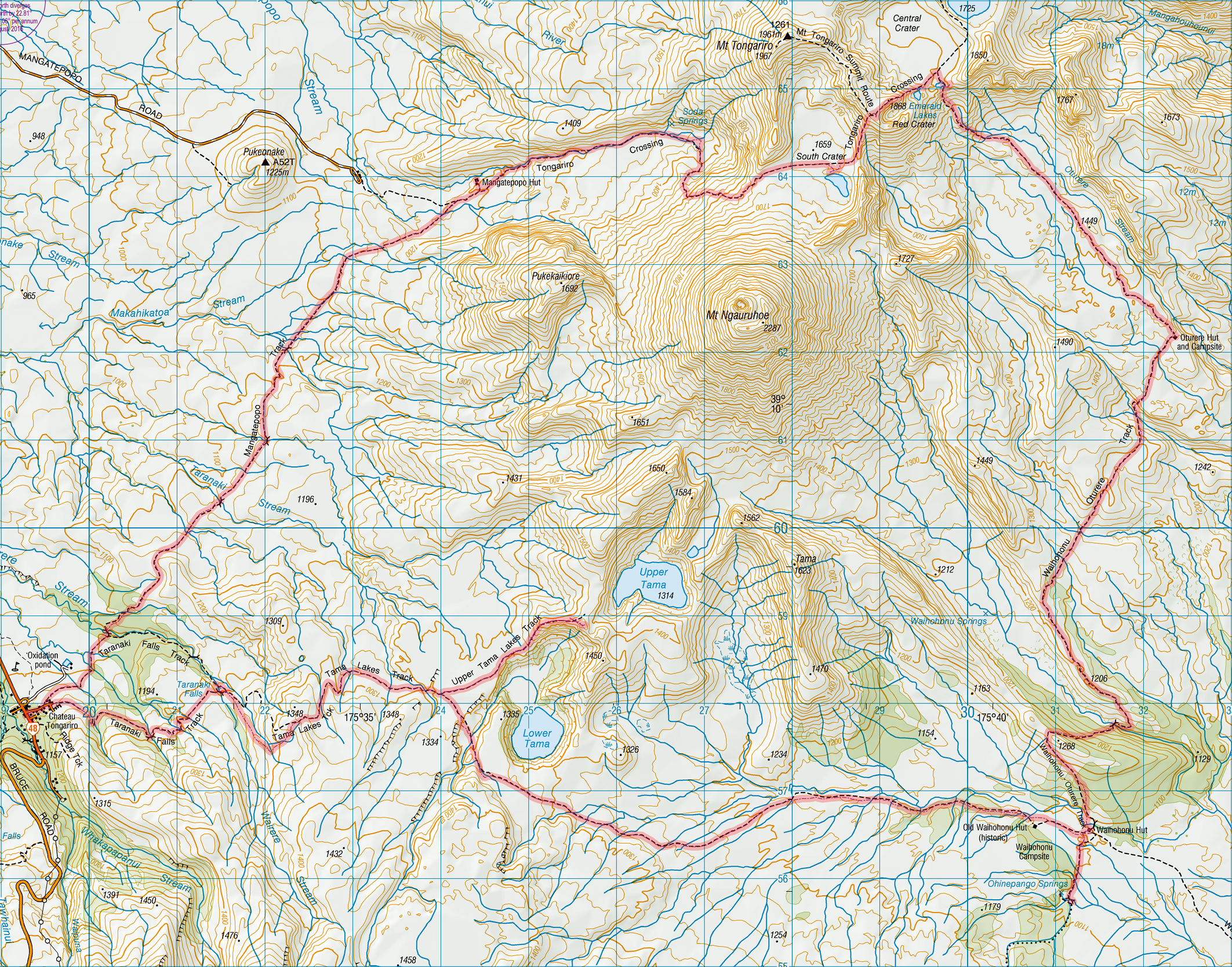
Tongariro Northern Circuit
Admittedly: The walk can be done in two days. But…
That would be turning into a raceway. If the weather is good, then the excursions to the Taranaki Falls and the Tama Lakes are indispensable. Since most of the track is very open, views from anywhere can be pretty spectacular, but these two sights should not be missed.
The Crossing itself passes between the two mountain peaks of Tongariro and Ngauruhoe and the question remains whether to climb these peaks. If the day’s section is only from Mangatepopo to Oturere or vice versa, then there would be time to attempt one peak. Ngauruhoe being much higher (2291 m) is more tempting than Tongariro (1978 m). However the surface of Ngauruhoe is loose scree and there is a real danger of snow falling at any time of the year, so that Tongariro is the better bet.
The condition of the “Hole” (Mangatepopo – Whakapapa) should be considered carefully. Recent rain will make this section almost impassable and in this case it is advisable to start or finish the track at the Mangatepopo carpark. Just make sure to arrange transport before starting the track. The bus that drops off the day hikers for the Crossing leaves at around 8:30.
For those with more time it is worth considering doing a section of the Round the Mountain track in addition. The southern part around Ruapehu is less crowded than the Great Walk, and most of the Northern Circuit can be done without having to stay in the Great Walk huts.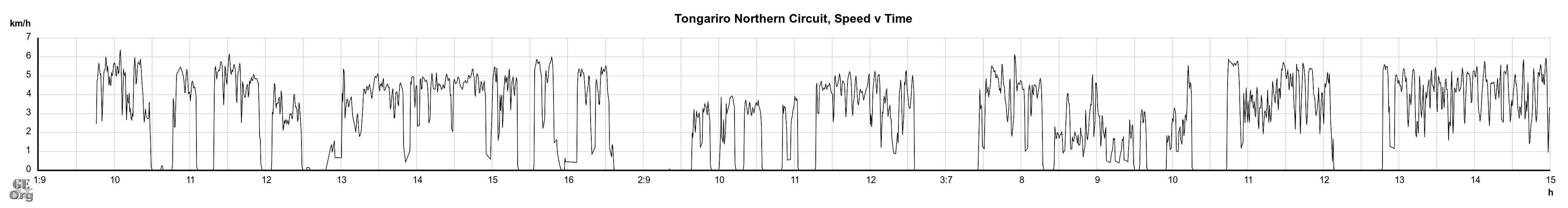
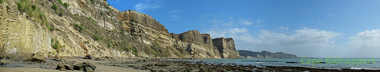
Waikaremoana
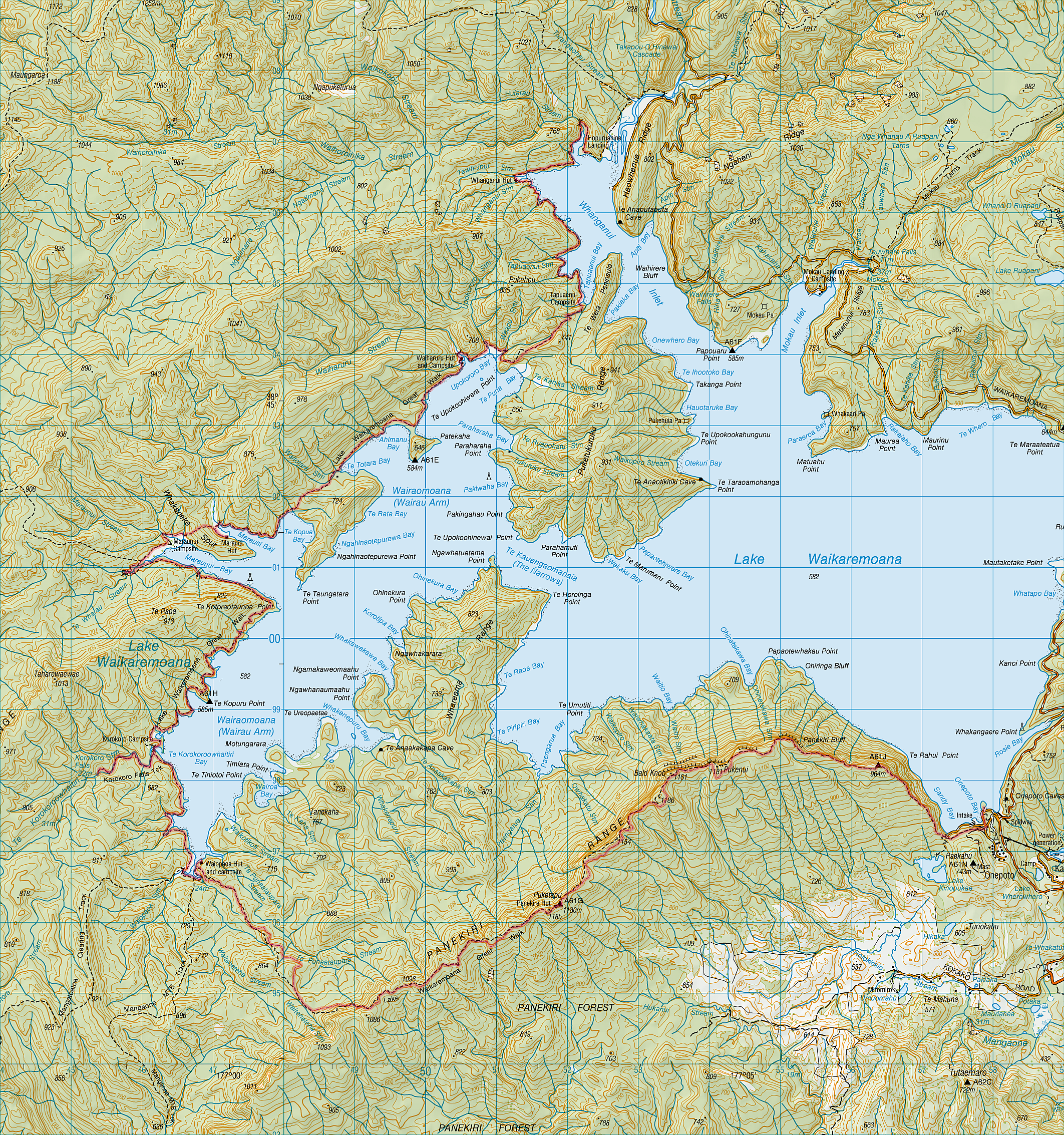
The next day we undertook the longest section, stopping for lunch at Marauiti and getting a little wet on the way to Waiharuru. The last day we sprinted along the track to the suspension bridge at Hopuruahine where we were picked up by separate shuttles around 1:00.
The track admits to quite some variation; even more if the camping grounds are taken into account. The water taxi will take you to most places, even to Waiopaoa for a day’s hike back over Panekire to Onepoto if you want to leave your car/camper there for the day. As for the water taxi: I ordered my place on the phone and gave them a credit card number for payment, but no payment was ever debited and the captain was reluctant to accept cash. I only hope that they didn’t go broke in the meantime.
Another possibility for exploring the lake would, of course, be by kayak, and I have seen advertising for kayak hire from Onepoto, if not from Home Bay. There are a couple of further campsites that are accessible by road that could be used for a kayak trip.
This is an extremely isolated area and there is no public transport to Home Bay or Onepoto. There is a motorcamp at Home Bay which also provides free secure parking, so that is an alternative for accommodation on the first or last night. The road from Wairoa is unsealed for the last 26 km, and for even longer in the direction of Rotorua, so don’t try arriving at the last minute and expecting to succeed at high speed.
Cape Brett
This is definitely a candidate for a Great Walk. Great views all the way along, and a very interesting bit of history as well. I recommend taking the side trip to Whangamumu if you are not suffering from cramps.
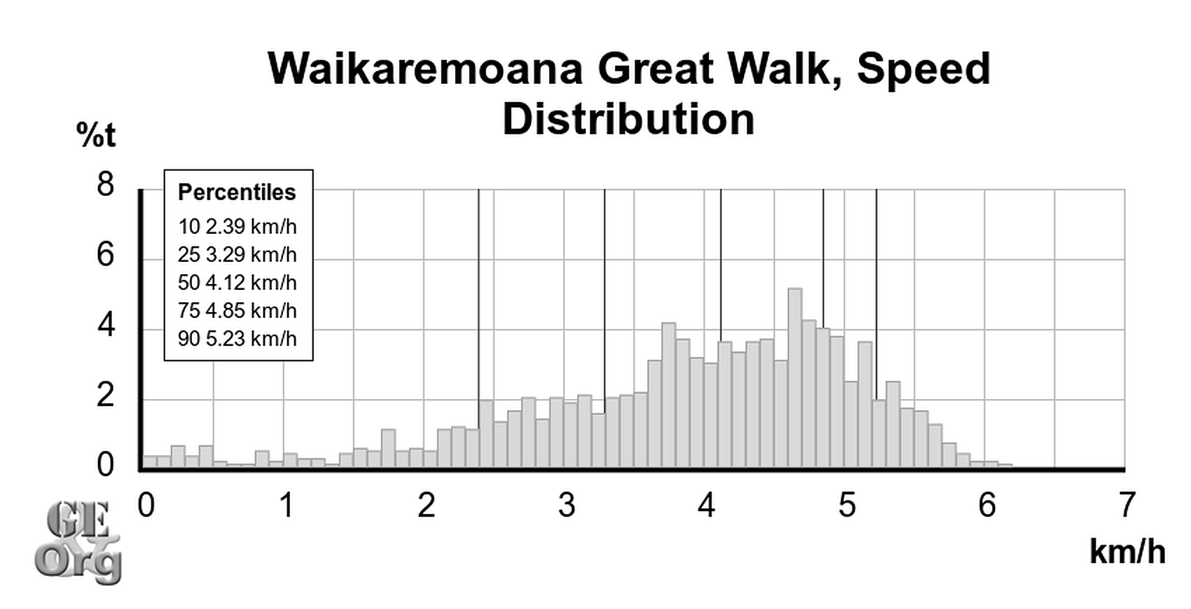
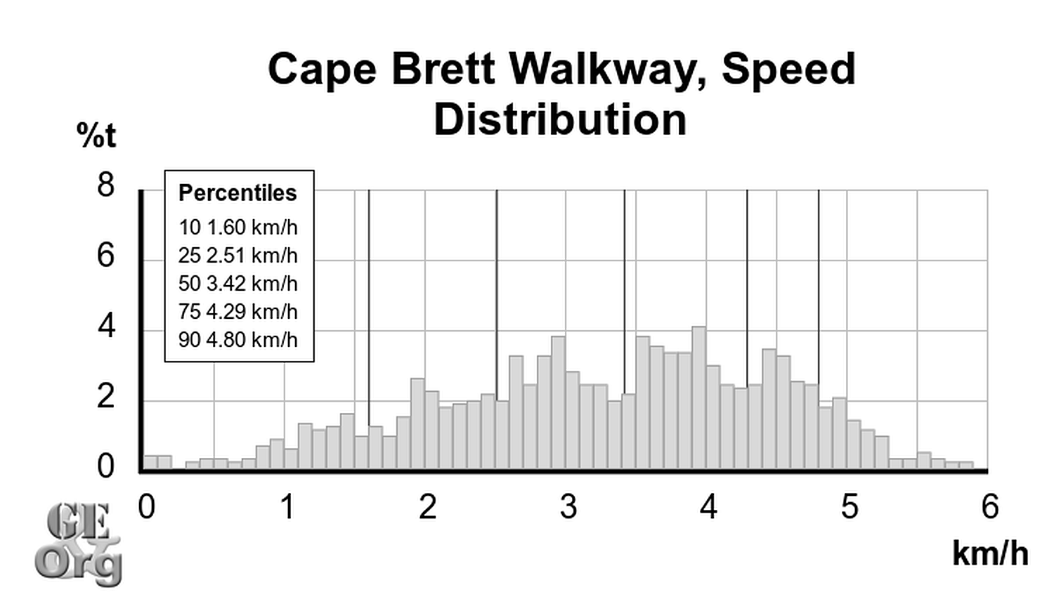
And as for the suffering: Does it make any difference? Let’s begin by comparing the speed distribution for two closely spaced practically two day walks, the Waikaremoana and Cape Brett.
About the only criticism I have is that the hut has no heating, so that if you were attempting this in bad weather you wouldn’t expect to have much fun. But in good weather sunset and sunrise have to be seen to be believed.